Online Services
Key Land Initiatives

Land Sales for Texas Veterans
We’ve prioritized land sales to Veterans since our agency was founded in 1836. Learn about our land sales initiatives.

Generating Revenue with State Land
Our management of Texas’ resource-rich land generates revenue for the state. This helps support our robust economy.

Ensuring Accurate Property Lines
Using the latest technology, we survey land around Texas to ensure clarity between state and private land.
Key Maps of State Land
See how our state land is used today.

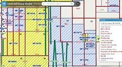
The Land & Lease Mapping Viewer, an interactive mapping application, provides access to vast collections of land- and energy-related data at the General Land Office. The Land & Lease Viewer displays upland and submerged Original Texas Land Survey boundaries, Permanent School Fund land, upland and coastal leases, oil and gas well locations, and current aerial imagery. This version does not require a third-party plugin and is compatible with most mobile devices.
"As the steward of 13 million acres of state land, from West Texas to our Gulf Coast beaches, our energy-rich land drives funding for our public schools, bolsters our oil and gas industry, fortifies public safety along our southern border, and ensures care for our state Veterans."
Commissioner Dawn Buckingham, M.D.
Contact Us
If you have a question about the Land program, find the right contact in our GLO Agency Directory.
GLO AGENCY DIRECTORY


